What if your quickest route to relaxation is a five-minute ride to your slip or mooring? If you love time on the water, choosing the right neighborhood in Portsmouth can change how often you actually get out there. You want easy access, the right type of dock or mooring, and a home that fits your lifestyle and budget. This guide covers the best boating access areas in town, what type of boater each suits, and practical tips to tour with confidence. Let’s dive in.
Portsmouth boating geography, at a glance
Portsmouth sits on Aquidneck Island with shoreline on both Narragansett Bay to the west and the Sakonnet River to the east. That means you can day-sail or power north toward Bristol or south toward Newport and beyond, with options to reach Buzzards Bay. Prudence Island is part of Portsmouth, offering a quieter, more rural boating lifestyle with island moorings and anchorages.
Rhode Island waters have two high and two low tides each day. Currents can run hard in narrow channels and near the Sakonnet, and shoals or ledges can appear in coves and approaches. Plan depth at low water, especially if you rely on a trailer ramp or dinghy, and time moves for slack water when possible. For live tide and current data and local chartlets, consult authoritative sources before you go.
Neighborhood quick guide for boaters
Below are Portsmouth’s main boating-access areas, what they offer, and who they fit best. Neighborhood boundaries and specific marina names should be verified with the town harbormaster or marina managers before you make decisions.
Melville / Northwestern shore
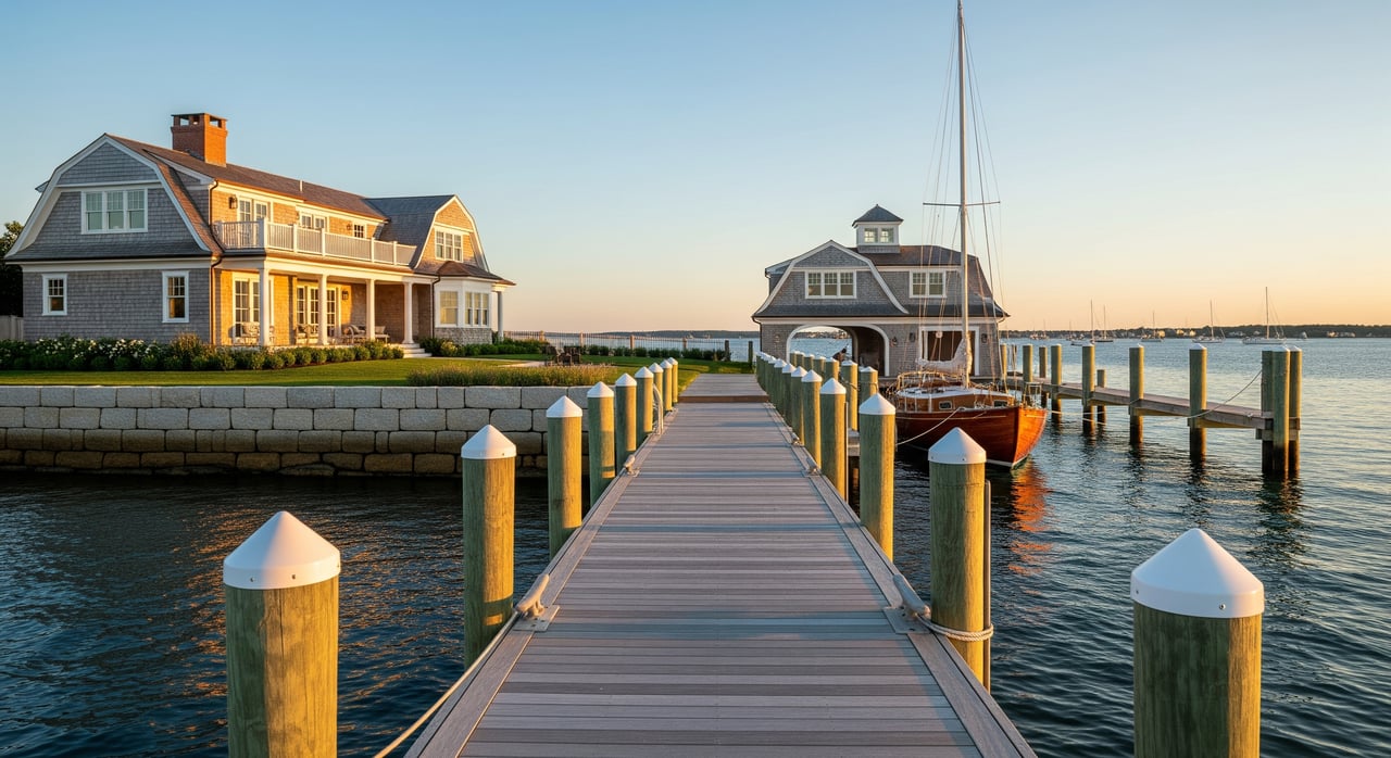
- Access profile: Clustered marinas and boatyards, protected basins, mooring fields, and service-rich facilities. Quick reach to open Narragansett Bay and Newport.
- Ideal for: Sailors and powerboaters who want slip convenience, fuel, winter storage, and on-site repairs. Racers may appreciate nearby organized sailing scenes.
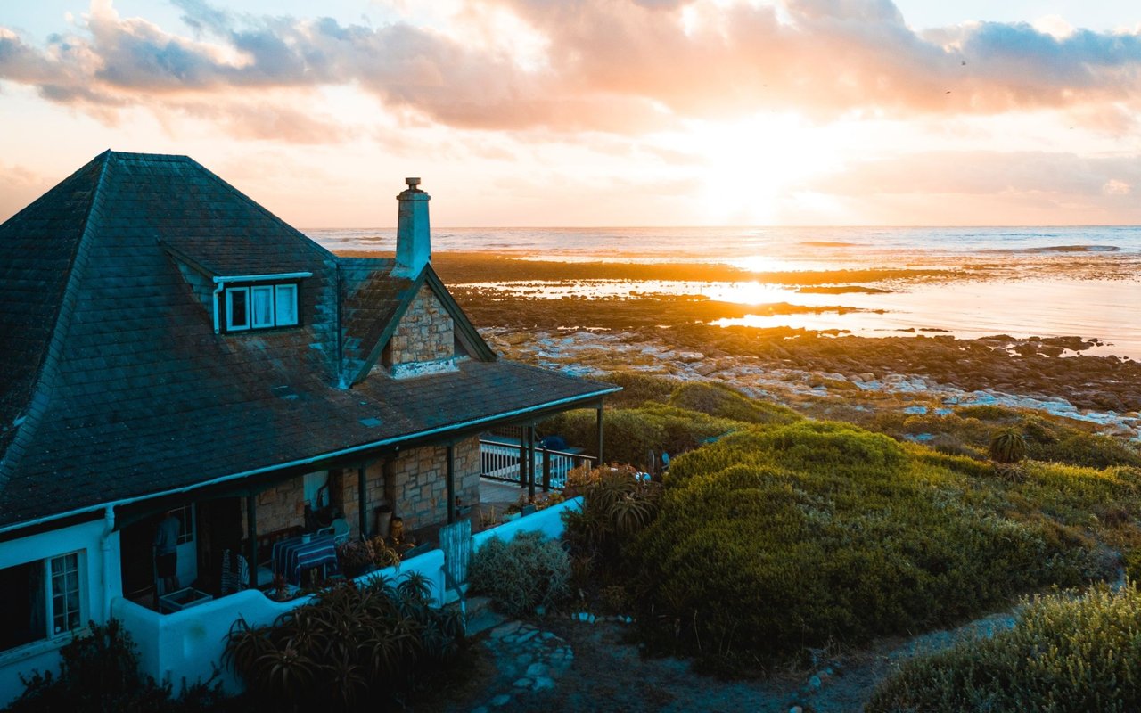
- Home types: Waterfront single-family with private or floating docks, condos adjacent to marina activity, and mid-century homes on modest lots.
- Tradeoffs: Convenience and services can carry a premium. Some basins are busy in peak season, and slip availability may involve waitlists.
Portsmouth Harbor / central waterfront
- Access profile: Mixed residential shoreline with public launch ramps, town-managed moorings, and small private docks. Easy drives to services and main roads.
- Ideal for: Trailer boaters, paddlers, and mooring users seeking balance between access and affordability.
- Home types: Older coastal cottages and colonials, some with private docks or bulkheads.
- Tradeoffs: Tidal depth matters at certain ramps and docks. Mooring fields often have rules and renewal periods to understand.
Eastern Sakonnet shore (Common Fence Point, Bristol-Ferry corridor)
- Access profile: Direct reach to the Sakonnet’s deeper channels and faster offshore transit. Stronger tidal streams are common.
- Ideal for: Larger powerboats and cruisers that benefit from deeper-water slips and moorings, plus quick runs to open water.
- Home types: Waterfront estates, ranches, and mid-century homes on larger lots, with some properties offering pilings or piers.
- Tradeoffs: Currents can be stronger on the Sakonnet side, and channel planning is important at peak ebb and flood.
Prudence Island
- Access profile: Island anchorages and moorings with a quieter, seasonal feel. Direct access to bay lanes.
- Ideal for: Owners who value a remote, low-key lifestyle and do not mind ferry logistics or tendering from moorings.
- Home types: Seasonal cottages and year-round homes with island utilities constraints. Many are walkable from the ferry or moorings.
- Tradeoffs: Fewer services and shops than the mainland. Weather and ferry schedules factor into routines, especially in shoulder seasons.
Small coves, peninsulas, and interior basins
- Access profile: Sheltered pockets and inlets with private or shared dock associations. More protection often means shallower draft constraints.
- Ideal for: Low-draft boats, dinghy sailors, paddlers, and owners who prioritize calm water nearby over deep-water access.
- Home types: Cottages and smaller waterfront lots, with some newer infill designed for dock convenience.
- Tradeoffs: Depth varies with tides, and some docks or ramps may be unusable at very low water.
Access types: docks, slips, moorings, and ramps
Choosing the right access is as important as choosing the right house. Here is what to expect in Portsmouth.
- Private docks and piers: Most convenient for daily use. They require permits, shoreline structure maintenance, and insurance. Verify ownership, riparian rights, and condition.
- Rented marina slips: Seasonal or annual options may include utilities, pump-out, security, fuel, haul-out, and winter storage. Contract terms vary by marina and location.
- Town or association moorings: Usually less expensive than slips. You will need a tender, dinghy storage, and a clear understanding of local mooring rules and renewal timelines.
- Transient moorings and anchoring: Useful for visitors and weekenders. Follow local anchoring limits, no-discharge rules, and any designated mooring field boundaries.
- Public launch ramps: Key for trailerable boats and kayaks. Confirm ramp depth, slope, parking rules, and whether resident permits are required.
Services to confirm ahead of time
- Fuel docks for gas or diesel
- Pump-out stations and no-discharge compliance
- Haul-out capacity, travel lift or crane
- On-site mechanics and chandlery
- Winter storage options (rack or yard)
- Availability of transient guest slips
Availability, waitlists, and costs
Highly desirable marinas in the Narragansett Bay region often use seasonal contracts and maintain waitlists. Town mooring fields may also have waitlists or application windows. Costs vary by boat length, location, and services included. Verify current rates and timelines directly with marina managers or the harbormaster before you commit.
Permits, rules, and environmental requirements
Mooring permits and buoy assignments are typically managed by the Town Harbormaster, with state oversight in some areas. RIDEM sets regulations for moorings, mooring fields, and protected habitats. Expect to follow no-discharge rules and use pump-out services. If you consider adding or modifying docks, bulkheads, or ramps, plan for permitting and potential community review.
Home types near boating access
You will see a range of options across Portsmouth’s shoreline.
- Waterfront single-family homes with private docks or bulkheads
- Condos or townhomes beside marinas, sometimes with deeded slips or shared docks
- Seasonal cottages and year-round houses on Prudence Island
- Homes just off the water but within a short walk to marinas or ramps
If you are evaluating a specific property, ask who owns and maintains any dock or bulkhead, and whether slip or mooring rights transfer. Do not assume a dock or mooring conveys with the home unless verified by the owner and relevant authority.
Insurance, flooding, and surveys
Flood zones, elevation, and foundation type affect insurance requirements and costs. You may need flood coverage through the NFIP or private markets. Bulkhead and pier condition matters for safety, insurability, and value. If you own a dock or slip, expect to carry appropriate liability coverage. Work with a marine surveyor and insurance professional to assess hull policies, liability needs, and common waterfront risk factors.
Recurring boating-related costs to plan for
- Dock or pier maintenance and inspections
- Winterizing, haul-out, and spring launch
- Mooring fees or marina dues
- Association or marina HOA fees if applicable
- Increased utilities at slips with shore power and water
- Occasional transient guest fees for visiting friends or backup plans
Lifestyle tradeoffs to consider
- Convenience vs cost: Private docks and marina slips save time but add fees and maintenance. Moorings are often cheaper, but you will rely on a tender and extra steps.
- Mainland vs island: Prudence Island offers direct bay access and serenity. Daily errands and services can take longer.
- Shelter vs depth: Protected coves are calmer yet shallower. Deeper channels on the Sakonnet side provide quick offshore runs with stronger currents.
Before you tour: a boater’s checklist
- Check tide and current tables for your visit time, noting low water for ramp depth and high water for dock access.
- Call the Town Harbormaster or the marina manager to confirm ramp status, parking rules, and transient slip procedures.
- Ask the listing agent and owner about seasonal depth changes, any low-water restrictions, and whether channel markers have shifted after winter storms.
- Bring a tape measure, flashlight, and phone camera for dock and bulkhead condition notes.
- If you plan on-water showings for mooring-based properties, arrange a tender and verify insurance and liability requirements.
On-the-water touring and launch tips
Aim for slack tide in narrow channels or shallow approaches to reduce grounding risk.
Observe speed limits, no-wake zones, and swimmer areas. Rules are enforced locally and by the U.S. Coast Guard in certain areas.
Trailer checklist:
- Confirm ramp width, slope, and surface condition.
- Verify trailer parking location and time limits.
- Check whether the ramp is resident-only, permit-based, or open to the public, and note any seasonal hours.
Safety notes to keep in mind:
- Currents can be strong at the Sakonnet River mouth and in constricted channels.
- Shoals may shift, especially after winter weather.
- Protected habitats such as eelgrass beds and shellfish flats can restrict anchoring and mooring placement.
Who to contact to verify details
- Town of Portsmouth Harbormaster for mooring permits, ramp info, buoy locations, and local rules.
- Rhode Island Department of Environmental Management for boating and mooring regulations, plus shellfish and habitat restrictions.
- NOAA Tides and Currents and NOAA nautical charts for tide times, charted depths, and aids to navigation.
- FEMA Flood Map Service Center for flood-zone and insurance considerations.
- U.S. Coast Guard local notices for safety zones and navigation changes.
- Marina managers and boatyard supervisors for slip availability, services, rates, and waitlists.
- Marine surveyors and insurance agents for dock, bulkhead, and policy guidance.
Ready to explore Portsmouth by water?
If you want your home and boat life to work seamlessly, local knowledge makes all the difference. From choosing the right cove for a low-draft skiff to verifying a mooring assignment, our team guides you through every step. Reach out to schedule a quick consult, virtual preview, or a tailored waterfront tour. Connect with Devin Sheehan to get started.
FAQs
What are the best boating-access neighborhoods in Portsmouth, RI?
- Melville, Portsmouth Harbor, the eastern Sakonnet shore, Prudence Island, and smaller coves all offer distinct access types with different tradeoffs.
How close are typical docks to open water in Portsmouth?
- Western shores reach Narragansett Bay quickly, while the eastern Sakonnet shore offers fast offshore access but stronger currents to consider.
Are slips or moorings easier to get in Portsmouth, RI?
- It varies by location and season, as many marinas and town mooring fields use waitlists; confirm current timelines with managers and the harbormaster.
Are Portsmouth public boat ramps open to non-residents?
- Some ramps are resident-only or permit-based and others may be open to the public; verify hours, parking and eligibility before you go.
What costs should I budget for boating access in Portsmouth?
- Expect line items for moorings or slip fees, winterizing and haul-out, dock maintenance, utilities at slips, and appropriate insurance coverage.
How do tides and currents affect boating in Portsmouth, RI?
- Plan for two highs and two lows daily, with strong currents in narrow channels and the Sakonnet; time moves at slack water when possible.
What permits do I need for a private dock in Portsmouth?
- Dock and shoreline structures usually require permits and reviews at the town and potentially state level; start with the Harbormaster and RIDEM for guidance.